Close
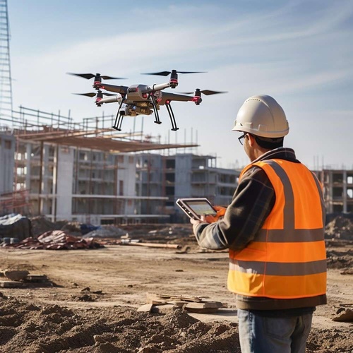
Our Drone Survey and Surveillance services deliver accurate, efficient, and cost-effective aerial insights for businesses across various industries. Using advanced drone technology equipped with high-resolution imaging, thermal sensors, and AI-driven analytics, we help organizations make informed decisions with real-time data.
We provide end-to-end drone survey solutions for land mapping, infrastructure inspection, asset monitoring, and environmental analysis. Our drones capture high-precision aerial data—orthomosaic maps, 3D models, volumetric measurements, and thermal scans—enabling faster, safer, and more reliable assessments compared to traditional methods.
All surveys are conducted by certified drone pilots to ensure precision, compliance, and high-quality data output as per project requirements.
We offer a range of high-performance industrial and commercial drones for purchase. From survey-grade UAVs to rugged inspection drones, we provide expert guidance to help clients select the right model for their operational needs. Our support includes product demos, accessories, licensing assistance, and after-sales services.
With our Drone-as-a-Service model, organizations can enhance security and monitoring without the cost of owning or maintaining drone fleets. We deploy drones for routine patrols, event monitoring, perimeter surveillance, and emergency response. AI-powered video analytics provide live alerts, threat detection, and automated reporting for enhanced situational awareness. Certified drone operators ensure that each surveillance mission is executed safely, accurately, and in line with regulatory standards.
Have questions or need a quote? Send us your enquiry and we’ll assist you with complete product details and pricing.